Maesygwartha Road, Gilwern
Introduction
The photograph on this page of Maesygwartha Road, Gilwern by Jaggery as part of the Geograph project.
The Geograph project started in 2005 with the aim of publishing, organising and preserving representative images for every square kilometre of Great Britain, Ireland and the Isle of Man.

There are currently over 7.5m images from over 14,400 individuals and you can help contribute to the project by visiting https://www.geograph.org.uk
Maesygwartha Road, Gilwern
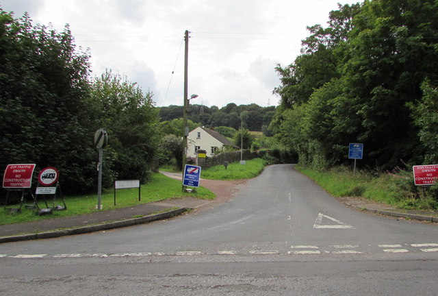
Image: © Jaggery Taken: 20 Aug 2017
The northern end of Maesygwartha Road, viewed across Church Road. In August 2017, two temporary signs show NO CONSTRUCTION TRAFFIC and the Welsh equivalent. Other signs show that the road ahead is unsuitable for heavy goods vehicles. There is a 7.5 tonnes vehicle weight limit, except for access. The 30mph speed limit on Church Road increases to the National Speed Limit.
Images are licensed for reuse under creativecommons.org/licenses/by-sa/2.0
Image Location
Latitude
51.825052
Longitude
-3.099652