Site (actual) of Littleton & Badsey station, 1998
Introduction
The photograph on this page of Site (actual) of Littleton & Badsey station, 1998 by Ben Brooksbank as part of the Geograph project.
The Geograph project started in 2005 with the aim of publishing, organising and preserving representative images for every square kilometre of Great Britain, Ireland and the Isle of Man.

There are currently over 7.5m images from over 14,400 individuals and you can help contribute to the project by visiting https://www.geograph.org.uk
Site (actual) of Littleton & Badsey station, 1998
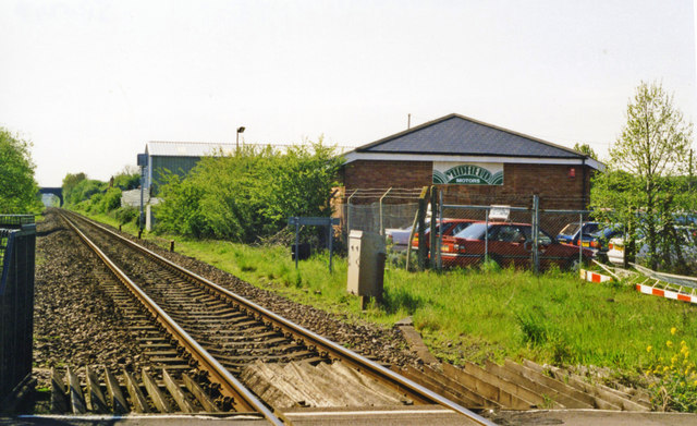
Image: © Ben Brooksbank Taken: 2 May 1998
View east, towards Honeybourne and Oxford: ex-GWR (London) Oxford - Worcester (Cotswold) main line. The station was closed 3/1/66, during the 'Beeching Period' when - pathetically - this main line was reduced to single track, from which it was not restored to normal double track until 8/11.
Images are licensed for reuse under creativecommons.org/licenses/by-sa/2.0
Image Location
Latitude
52.101583
Longitude
-1.89922