Ferry Lane, Winteringham, Lincolnshire
Introduction
The photograph on this page of Ferry Lane, Winteringham, Lincolnshire by Bernard Sharp as part of the Geograph project.
The Geograph project started in 2005 with the aim of publishing, organising and preserving representative images for every square kilometre of Great Britain, Ireland and the Isle of Man.

There are currently over 7.5m images from over 14,400 individuals and you can help contribute to the project by visiting https://www.geograph.org.uk
Ferry Lane, Winteringham, Lincolnshire
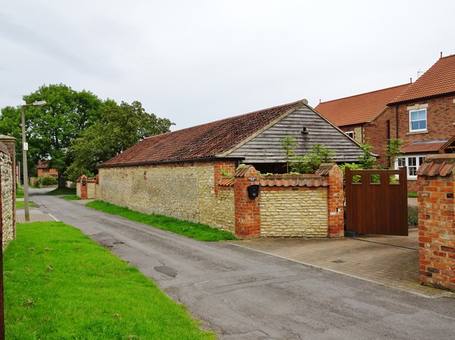
Image: © Bernard Sharp Taken: 14 Aug 2017
On 21 December 2007, North Lincolnshire Council granted planning approval to erect two 5-bedroom houses and part demolish and convert outbuildings to form associated garaging and vehicular access on land in Ferry Lane. Depicted is the former farm outbuilding converted to two garages for the new-build houses The Manor House and The Farmhouse, Nos. 12 & 10 Ferry Lane respectively.
Images are licensed for reuse under creativecommons.org/licenses/by-sa/2.0
Image Location
Latitude
53.688947
Longitude
-0.59106