Converted outbuildings at St Thomas's Priory Farm
Introduction
The photograph on this page of Converted outbuildings at St Thomas's Priory Farm by Alan Murray-Rust as part of the Geograph project.
The Geograph project started in 2005 with the aim of publishing, organising and preserving representative images for every square kilometre of Great Britain, Ireland and the Isle of Man.

There are currently over 7.5m images from over 14,400 individuals and you can help contribute to the project by visiting https://www.geograph.org.uk
Converted outbuildings at St Thomas's Priory Farm
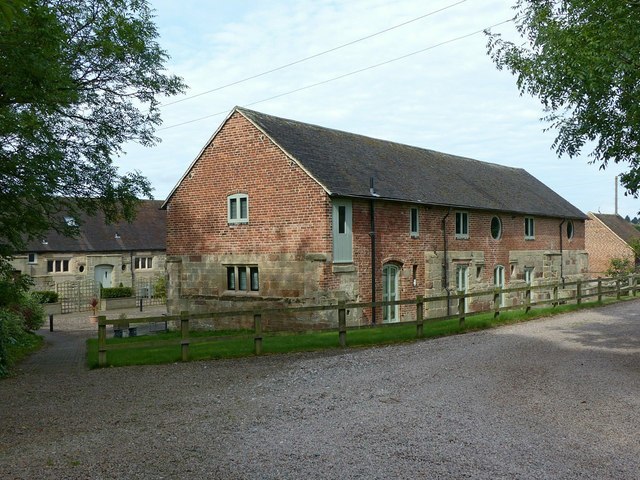
Image: © Alan Murray-Rust Taken: 16 Aug 2017
These are based on masonry from the original St Thomas's Priory, an Augustinian foundation, although it is unclear how much of the actual medieval buildings remain. Much of the detailing is of the Tudor period. There are two ranges which have been sympathetically converted into residential accommodation. Listed Grade II. The surrounding area is designated as a Scheduled Monument.
Images are licensed for reuse under creativecommons.org/licenses/by-sa/2.0
Image Location
Latitude
52.80417
Longitude
-2.075608