Ding Park Vicinity, St Philips, Bristol 2
Introduction
The photograph on this page of Ding Park Vicinity, St Philips, Bristol 2 by David Hallam-Jones as part of the Geograph project.
The Geograph project started in 2005 with the aim of publishing, organising and preserving representative images for every square kilometre of Great Britain, Ireland and the Isle of Man.

There are currently over 7.5m images from over 14,400 individuals and you can help contribute to the project by visiting https://www.geograph.org.uk
Ding Park Vicinity, St Philips, Bristol 2
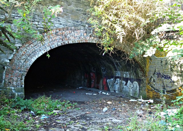
Image: © David Hallam-Jones Taken: 13 Aug 2017
An unmaintained cobbled road 75 metres long between the children's playground area and a small all-weather sports pitch for older children leads to this low tunnel beneath some of the railway lines that enter and exit the approach to Temple Meads Railway Station. Exiting it at the other end would bring a child or a stooping adult into Freestone Road. It seems an unsavoury and unsafe space in an area used by children.
Images are licensed for reuse under creativecommons.org/licenses/by-sa/2.0
Image Location
Latitude
51.451692
Longitude
-2.574728