Barton Road, St Philip's, Bristol 2
Introduction
The photograph on this page of Barton Road, St Philip's, Bristol 2 by David Hallam-Jones as part of the Geograph project.
The Geograph project started in 2005 with the aim of publishing, organising and preserving representative images for every square kilometre of Great Britain, Ireland and the Isle of Man.

There are currently over 7.5m images from over 14,400 individuals and you can help contribute to the project by visiting https://www.geograph.org.uk
Barton Road, St Philip's, Bristol 2
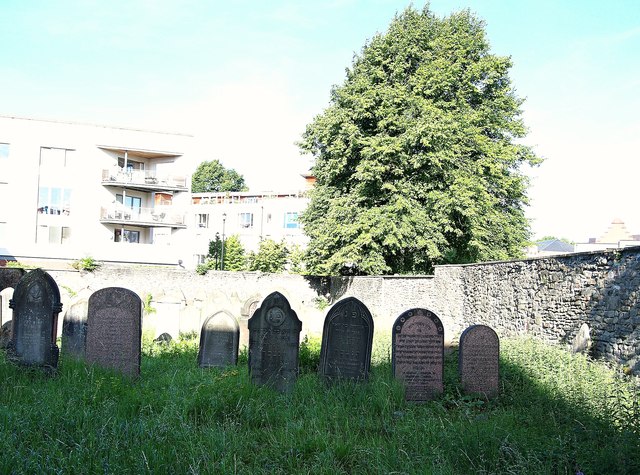
Image: © David Hallam-Jones Taken: 13 Aug 2017
This gated-and-locked Jewish cemetery is obliquely opposite the Barley Mow pub. Its establishment in the 1740s makes it the first in Bristol following the return of Jews to England following their expulsion of 1290. The earliest grave is dated 1762 and the most recent one in 1944. Bristol is one of the oldest provincial Jewish communities in the UK with records of a Jewish community dating back to the C12th and C13th. Because of the restrictions on Jews owning land it was leased for a number of years, finally being acquired by the Bristol Jewish Community in 1859. There are approximately 160 graves. The houses in the distance are in Sweetman Place.
Images are licensed for reuse under creativecommons.org/licenses/by-sa/2.0
Image Location
Latitude
51.453115
Longitude
-2.577912