Forbes Place
Introduction
The photograph on this page of Forbes Place by Thomas Nugent as part of the Geograph project.
The Geograph project started in 2005 with the aim of publishing, organising and preserving representative images for every square kilometre of Great Britain, Ireland and the Isle of Man.

There are currently over 7.5m images from over 14,400 individuals and you can help contribute to the project by visiting https://www.geograph.org.uk
Forbes Place
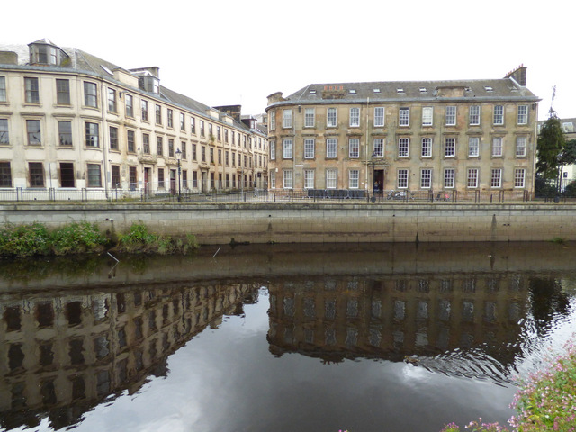
Image: © Thomas Nugent Taken: 7 Aug 2017
Viewed across White Cart Water. The building on the right is Category C Listed http://portal.historicenvironment.scot/designation/LB38974 , the one on the left is Category B Listed http://portal.historicenvironment.scot/designation/LB38977 .
Images are licensed for reuse under creativecommons.org/licenses/by-sa/2.0
Image Location
Latitude
55.844069
Longitude
-4.42213