The Square
Introduction
The photograph on this page of The Square by Michael Dibb as part of the Geograph project.
The Geograph project started in 2005 with the aim of publishing, organising and preserving representative images for every square kilometre of Great Britain, Ireland and the Isle of Man.

There are currently over 7.5m images from over 14,400 individuals and you can help contribute to the project by visiting https://www.geograph.org.uk
The Square
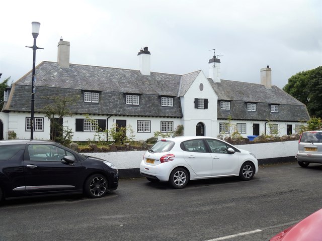
Image: © Michael Dibb Taken: 29 Jul 2017
These 5 cottages, along with two houses make up The Square, built in 1912. The cottages are listed and there is much detail and history at: http://appsc.doeni.gov.uk/buildings/buildview.aspx?id=3080&js=false http://appsc.doeni.gov.uk/buildings/buildview.aspx?id=8772&js=false http://appsc.doeni.gov.uk/buildings/buildview.aspx?id=8773&js=false http://appsc.doeni.gov.uk/buildings/buildview.aspx?id=8774&js=false & http://appsc.doeni.gov.uk/buildings/buildview.aspx?id=8775&js=false
Images are licensed for reuse under creativecommons.org/licenses/by-sa/2.0
Image Location
Latitude
55.125517
Longitude
-6.043303