Closed footpath
Introduction
The photograph on this page of Closed footpath by John Baker as part of the Geograph project.
The Geograph project started in 2005 with the aim of publishing, organising and preserving representative images for every square kilometre of Great Britain, Ireland and the Isle of Man.

There are currently over 7.5m images from over 14,400 individuals and you can help contribute to the project by visiting https://www.geograph.org.uk
Closed footpath
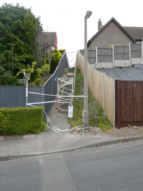
Image: © John Baker Taken: 16 Jul 2017
A notice, affixed to the handrail at the bottom of the steps, gave members of the public to understand that footpath ER3 would be closed from 6 July 2017 for no more than 21 days. Also that the path was closed between Sea Road and Clim Down because of potential danger to the public while the problem was resolved/repairs undertaken. A map, below the notice, indicated that the alternative route was by road. This entailed walking to the end of King’s Close and into Glen Road. Here it was a right turn and then, after a few paces, another right turn into Sea Road to follow this road until the steps were reached.
Images are licensed for reuse under creativecommons.org/licenses/by-sa/2.0
Image Location
Latitude
51.187491
Longitude
1.398318