
Gleaston Castle
Introduction
The photograph on this page of Gleaston Castle by G Laird as part of the Geograph project.
The Geograph project started in 2005 with the aim of publishing, organising and preserving representative images for every square kilometre of Great Britain, Ireland and the Isle of Man.

There are currently over 7.5m images from over 14,400 individuals and you can help contribute to the project by visiting https://www.geograph.org.uk
Gleaston Castle
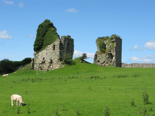
Image: © G Laird Taken: 9 Aug 2017
Gleaston Castle lies about half a mile north-east of Gleaston village, off the road to Scales. It dates from around 1350 and is thought to have been built by John de Harrington. Its walls are nine feet thick and reveal that the castle was carelessly built of limestone rubble in roughly dressed blocks of various sizes. Only a few blocks of dressed red sandstone have been used around doors and windows. By the 16th century, the castle was the property of Henry, Duke of Suffolk. When he and his daughter Lady Jane Grey were executed on the authority of Queen Mary, the castle passed into the hands of the crown. By this time, however, the building was already disused, and it gradually fell into decay.
Images are licensed for reuse under creativecommons.org/licenses/by-sa/2.0
Image Location

Latitude
54.133656
Longitude
-3.13189