North Perrott village green
Introduction
The photograph on this page of North Perrott village green by Bill Harrison as part of the Geograph project.
The Geograph project started in 2005 with the aim of publishing, organising and preserving representative images for every square kilometre of Great Britain, Ireland and the Isle of Man.

There are currently over 7.5m images from over 14,400 individuals and you can help contribute to the project by visiting https://www.geograph.org.uk
North Perrott village green
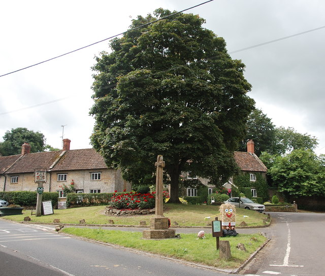
Image: © Bill Harrison Taken: 8 Jul 2016
The tiny village green at the junction of the A3066 and Church Lane accommodates the war memorial from ca. 1920: http://www.britishlistedbuildings.co.uk/101435241-north-perrott-war-memorial-north-perrott#.WY4NGyaWyAg and just visible beside the silver car, the base of the medieval cross: http://www.britishlistedbuildings.co.uk/101175905-base-of-former-village-cross-about-15-metres-west-of-manor-arms-inn-north-perrott#.WY4NVCaWyAg .
Images are licensed for reuse under creativecommons.org/licenses/by-sa/2.0
Image Location
Latitude
50.8825
Longitude
-2.748225