Mounting block
Introduction
The photograph on this page of Mounting block by Ian Capper as part of the Geograph project.
The Geograph project started in 2005 with the aim of publishing, organising and preserving representative images for every square kilometre of Great Britain, Ireland and the Isle of Man.

There are currently over 7.5m images from over 14,400 individuals and you can help contribute to the project by visiting https://www.geograph.org.uk
Mounting block
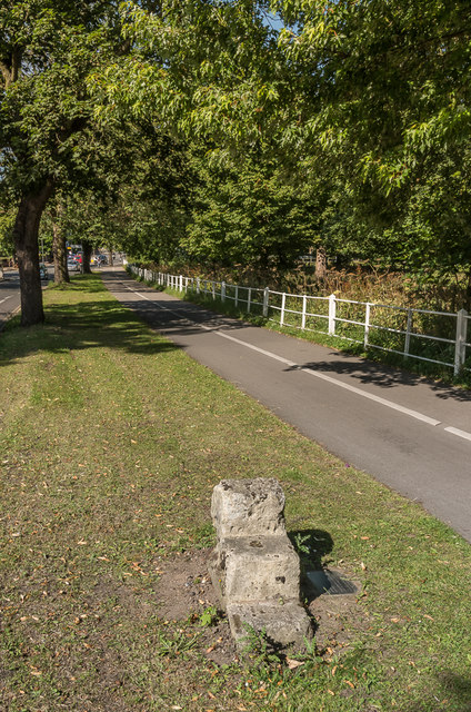
Image: © Ian Capper Taken: 18 Jul 2017
A mounting block alongside Tadcaster Road. The inscription on the plaque on alongside reads: This stone mounting block was formerly used as the first milestone from York, measured from Ouse Bridge. It also marked the re-entrant angle of the City Boundary of 1832. Grade II listed - see www.historicengland.org.uk/listing/the-list/list-entry/1256502. For a closer view see Image and for a wider view see Image
Images are licensed for reuse under creativecommons.org/licenses/by-sa/2.0
Image Location


Leaflet Map data © OpenStreetMap
Latitude
53.947962
Longitude
-1.10053