Poplar Farm, Dale Abbey
Introduction
The photograph on this page of Poplar Farm, Dale Abbey by Alan Murray-Rust as part of the Geograph project.
The Geograph project started in 2005 with the aim of publishing, organising and preserving representative images for every square kilometre of Great Britain, Ireland and the Isle of Man.

There are currently over 7.5m images from over 14,400 individuals and you can help contribute to the project by visiting https://www.geograph.org.uk
Poplar Farm, Dale Abbey
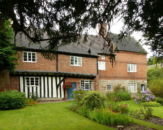
Image: © Alan Murray-Rust Taken: 6 Aug 2017
Listed by Historic England as Friar's House, the stone elements of the ground floor to the right date from the 15th century and would have been part of the abbey buildings. The upper storey of this section is early 18th century. The left hand, timber framed, section dates back to the 17th century (Listing description) or even earlier (Derbyshire HER record http://www.heritagegateway.org.uk/Gateway/Results_Single.aspx?uid=MDR10775&resourceID=1023 ). Listed Grade II.
Images are licensed for reuse under creativecommons.org/licenses/by-sa/2.0
Image Location
Latitude
52.944192
Longitude
-1.352176