St Margaret's Church, Tintinhull
Introduction
The photograph on this page of St Margaret's Church, Tintinhull by Bill Harrison as part of the Geograph project.
The Geograph project started in 2005 with the aim of publishing, organising and preserving representative images for every square kilometre of Great Britain, Ireland and the Isle of Man.

There are currently over 7.5m images from over 14,400 individuals and you can help contribute to the project by visiting https://www.geograph.org.uk
St Margaret's Church, Tintinhull
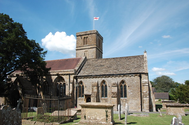
Image: © Bill Harrison Taken: 14 Jul 2016
The chancel windows of the Grade-I building (http://www.britishlistedbuildings.co.uk/101235407-church-of-st-margaret-tintinhull#.WYoWFyaWyAg ) date from the 13th Century. The lower part of the tower is also 13th Century, but the upper storey is 16th Century. The Poole monument (chest tomb) from ca. 1806 is in the foreground.
Images are licensed for reuse under creativecommons.org/licenses/by-sa/2.0
Image Location
Latitude
50.974518
Longitude
-2.71552