Ferring Rife
Introduction
The photograph on this page of Ferring Rife by Simon Carey as part of the Geograph project.
The Geograph project started in 2005 with the aim of publishing, organising and preserving representative images for every square kilometre of Great Britain, Ireland and the Isle of Man.

There are currently over 7.5m images from over 14,400 individuals and you can help contribute to the project by visiting https://www.geograph.org.uk
Ferring Rife
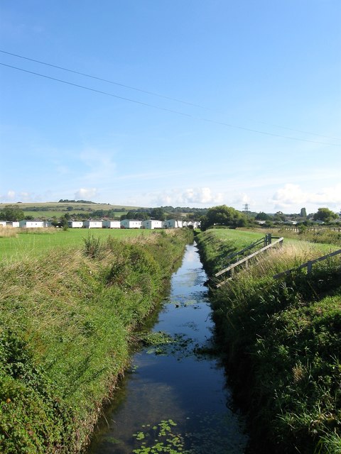
Image: © Simon Carey Taken: 6 Aug 2017
Viewed from the entrance to Ferring Country Centre with Image to the west and Image to the east. Ferring Rife is small waterway that rises in Durrington and enters the sea via an outfall on the south western edge of Ferring parish. Rife is a local Sussex dialect word for a small river and the name is particularly numerous on the coastal plain between Worthing and Chichester. It is the eastern most example. Highdown Hill can be seen in the background.
Images are licensed for reuse under creativecommons.org/licenses/by-sa/2.0
Image Location
Latitude
50.815135
Longitude
-0.45442