High Ousegate
Introduction
The photograph on this page of High Ousegate by Ian Capper as part of the Geograph project.
The Geograph project started in 2005 with the aim of publishing, organising and preserving representative images for every square kilometre of Great Britain, Ireland and the Isle of Man.

There are currently over 7.5m images from over 14,400 individuals and you can help contribute to the project by visiting https://www.geograph.org.uk
High Ousegate
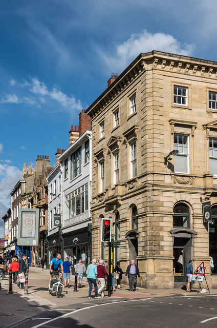
Image: © Ian Capper Taken: 20 Jul 2017
Looking along High Ousegate from its junction with Spurriegate and Nessgate. The building on the corner, 1 Nessgate, was built in 1839 for the Yorkshire Agricultural and Commercial Bank, a company which failed in 1842, although maps suggest that it continued to be used as a bank until at leastthe late 20th Century. It now houses a branch of the clothes retailer, Fat Face. Grade II listed - see www.historicengland.org.uk/listing/the-list/list-entry/1257090.
Images are licensed for reuse under creativecommons.org/licenses/by-sa/2.0
Image Location
Latitude
53.957799
Longitude
-1.082121