
Priory Farm, Hinton St George
Introduction
The photograph on this page of Priory Farm, Hinton St George by Derek Harper as part of the Geograph project.
The Geograph project started in 2005 with the aim of publishing, organising and preserving representative images for every square kilometre of Great Britain, Ireland and the Isle of Man.

There are currently over 7.5m images from over 14,400 individuals and you can help contribute to the project by visiting https://www.geograph.org.uk
Priory Farm, Hinton St George
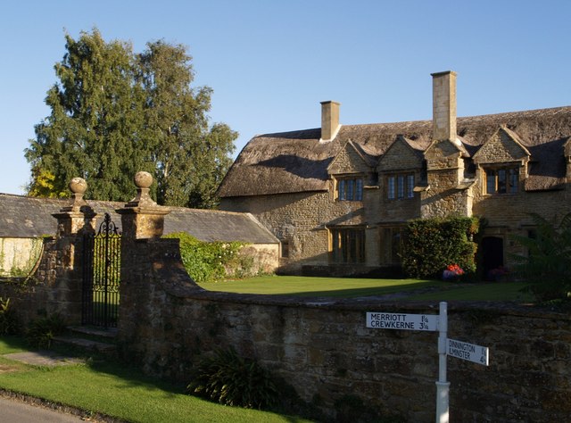
Image: © Derek Harper Taken: 4 Sep 2007
A number of fine Ham stone farmhouses are found in Hinton St George. Priory Farm, at the main junction in the centre of the village is the most impressive. It dates from the C14 onwards; complete architectural information is at http://webapp1.somerset.gov.uk/her/details.asp?prn=58992 , which says "it is possible that the house predated Hinton House as the Manor House: it may have been in the possession of Monkton Farleigh Priory". The building straddles an easting gridline; most of the eastern part shown in the photo is in ST4212, but the photo was taken about 20 metres west of the gridline.
Images are licensed for reuse under creativecommons.org/licenses/by-sa/2.0
Image Location

Latitude
50.90994
Longitude
-2.826325