Shepherd's Cottage, Beer
Introduction
The photograph on this page of Shepherd's Cottage, Beer by Richard Law as part of the Geograph project.
The Geograph project started in 2005 with the aim of publishing, organising and preserving representative images for every square kilometre of Great Britain, Ireland and the Isle of Man.

There are currently over 7.5m images from over 14,400 individuals and you can help contribute to the project by visiting https://www.geograph.org.uk
Shepherd's Cottage, Beer
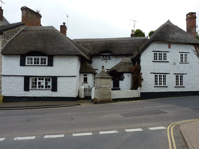
Image: © Richard Law Taken: 16 Jul 2017
Originally built as (probably) three separate houses in the late 17th or early 18th Century, they are now combined into a single property which was Grade II listed https://www.britishlistedbuildings.co.uk/101306439-shepherds-cottage-beer#.WYLKAoQrKM8 in 1967. The stone conduit head (with the road sign attached) is also listed https://www.britishlistedbuildings.co.uk/101098610-conduit-head-immediately-north-east-of-shepherds-cottage-beer#.WYLKn4QrKM8
Images are licensed for reuse under creativecommons.org/licenses/by-sa/2.0
Image Location
Latitude
50.699282
Longitude
-3.094061