1, Common Lane
Introduction
The photograph on this page of 1, Common Lane by Richard Law as part of the Geograph project.
The Geograph project started in 2005 with the aim of publishing, organising and preserving representative images for every square kilometre of Great Britain, Ireland and the Isle of Man.

There are currently over 7.5m images from over 14,400 individuals and you can help contribute to the project by visiting https://www.geograph.org.uk
1, Common Lane
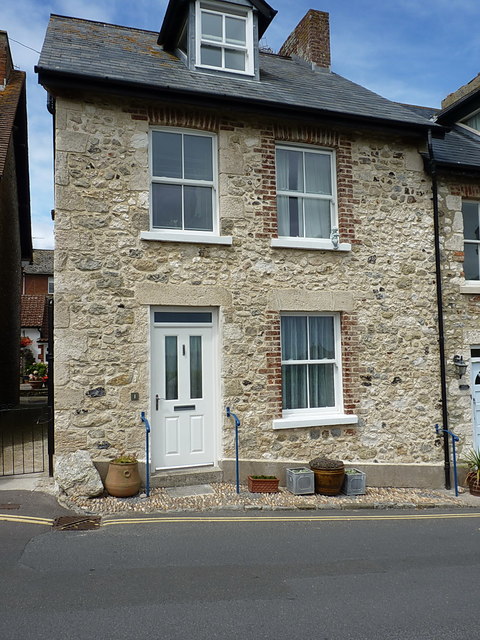
Image: © Richard Law Taken: 16 Jul 2017
One of a pair of near-identical terraced cottages on Common Lane, which leads SW out of Beer to South Down Common. The walls are built of the attractive local Beer Stone, a chalky limestone quarried just up the hill to the west.
Images are licensed for reuse under creativecommons.org/licenses/by-sa/2.0
Image Location
Latitude
50.696962
Longitude
-3.092166