Warren Farmhouse, Church Street
Introduction
The photograph on this page of Warren Farmhouse, Church Street by Richard Law as part of the Geograph project.
The Geograph project started in 2005 with the aim of publishing, organising and preserving representative images for every square kilometre of Great Britain, Ireland and the Isle of Man.

There are currently over 7.5m images from over 14,400 individuals and you can help contribute to the project by visiting https://www.geograph.org.uk
Warren Farmhouse, Church Street
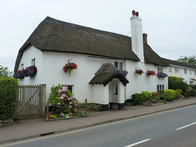
Image: © Richard Law Taken: 15 Jul 2017
The original farmhouse of the area, after which the modern housing developments in Image will have been named when they were built on its land. The house was given a Grade II listing https://www.britishlistedbuildings.co.uk/101333809-warrens-farmhouse-sidmouth#.WXtY9tQrLGg in 1973, and dates from the 18th Century.
Images are licensed for reuse under creativecommons.org/licenses/by-sa/2.0
Image Location
Latitude
50.703017
Longitude
-3.224855