2007 : View from Bathford Hill
Introduction
The photograph on this page of 2007 : View from Bathford Hill by Maurice Pullin as part of the Geograph project.
The Geograph project started in 2005 with the aim of publishing, organising and preserving representative images for every square kilometre of Great Britain, Ireland and the Isle of Man.

There are currently over 7.5m images from over 14,400 individuals and you can help contribute to the project by visiting https://www.geograph.org.uk
2007 : View from Bathford Hill
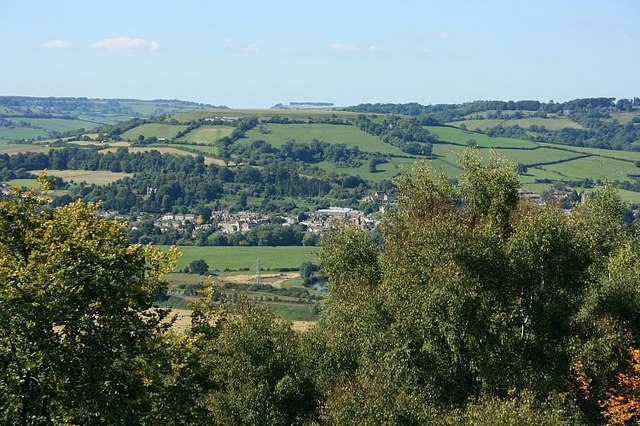
Image: © Maurice Pullin Taken: 4 Sep 2007
Taken from a clear patch on Bathford Hill. On the distant skyline in the centre is a row of trees planted along the top of Freezing Hill. ST7271 Immediately beneath them, and just below the skyline is the top of Little Solsbury Hill. ST7667 Moving left we can see the northern end of Lansdown, where the battle of Lansdown was fought in 1643. Lansdown Hill continues to the edge of the picture. To the right of Freezing Hill part of Charmy Down appears, there is a disused airfield at the top which is still put to good use by model aeroplane and glider enthusiasts. About half way down we have part of Batheaston, the railway line out of Bath and the Batheaston bypass are almost hidden by the trees at the bottom.
Images are licensed for reuse under creativecommons.org/licenses/by-sa/2.0
Image Location
Latitude
51.39885
Longitude
-2.302963