Grenfell Tower
Introduction
The photograph on this page of Grenfell Tower by Marathon as part of the Geograph project.
The Geograph project started in 2005 with the aim of publishing, organising and preserving representative images for every square kilometre of Great Britain, Ireland and the Isle of Man.

There are currently over 7.5m images from over 14,400 individuals and you can help contribute to the project by visiting https://www.geograph.org.uk
Grenfell Tower
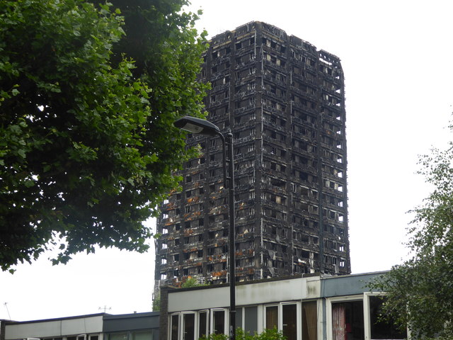
Image: © Marathon Taken: 19 Jul 2017
I thought long and hard about posting this photograph. I was shocked to actually see Grenfell Tower as you do not get a full impression from news photographs compared to actually standing there and looking up at it. An elderly West Indian gentleman who lived nearby, and who had been up all night watching the fire and who had been to every meeting since, saw me looking at the blackened remains and asked what my thoughts were. I told him that it was even more horrifying to actually stand and see it and try to imagine what the people inside on 14th June had gone through. He talked to me for a long time and said he was glad that people away from the immediate area were coming to visit and also look at the tributes. Then you read the mass of tributes nearby on railings and all the "have you seen?" messages when you know the fate of the ones they are looking for. There was even a "have you seen my dog?" photo. The anger comes through very clearly but the man I spoke to said they were angry but they would always pull together as a community. See also http://www.geograph.org.uk/photo/5474662 and http://www.geograph.org.uk/photo/5474631
Images are licensed for reuse under creativecommons.org/licenses/by-sa/2.0
Image Location
Latitude
51.513987
Longitude
-0.215859