Ruined Chalet on Hagg's Hall Field
Introduction
The photograph on this page of Ruined Chalet on Hagg's Hall Field by Chris Heaton as part of the Geograph project.
The Geograph project started in 2005 with the aim of publishing, organising and preserving representative images for every square kilometre of Great Britain, Ireland and the Isle of Man.

There are currently over 7.5m images from over 14,400 individuals and you can help contribute to the project by visiting https://www.geograph.org.uk
Ruined Chalet on Hagg's Hall Field
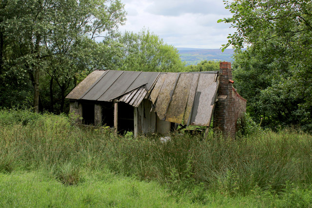
Image: © Chris Heaton Taken: 20 Jul 2017
On the track between Ramsgreave and Hagg's Hall there is a row of ruined chalets, partially concealed in woods. Some have been reduced to brick chimney stacks only, others are as the example in the photograph. They all have fine views overlooking the Ribble Valley, but alas, abandoned and in disrepair. They were probably erected in the 1920's or 1930's, when chalets of this type were popular.
Images are licensed for reuse under creativecommons.org/licenses/by-sa/2.0
Image Location


Leaflet Map data © OpenStreetMap
Latitude
53.782317
Longitude
-2.493796