The Mersey estuary from the air
Introduction
The photograph on this page of The Mersey estuary from the air by Thomas Nugent as part of the Geograph project.
The Geograph project started in 2005 with the aim of publishing, organising and preserving representative images for every square kilometre of Great Britain, Ireland and the Isle of Man.

There are currently over 7.5m images from over 14,400 individuals and you can help contribute to the project by visiting https://www.geograph.org.uk
The Mersey estuary from the air
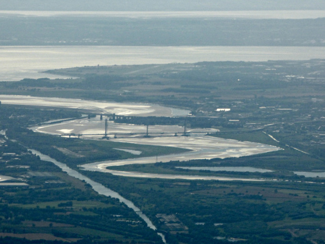
Image: © Thomas Nugent Taken: 17 Jul 2017
Seen around two minutes after take-off from runway 23L at Manchester Airport. The new Mersey Gateway bridge, which is nearing completion, can be seen in the centre, with the current Silver Jubilee Bridge beyond. The runway at John Lennon airport is also visible in the distance. The Manchester Ship Canal is in the lower left corner.
Images are licensed for reuse under creativecommons.org/licenses/by-sa/2.0
Image Location
Latitude
53.36473
Longitude
-2.625101