
Plantation Panorama; Epping Forest Buffer Lands
Introduction
The photograph on this page of Plantation Panorama; Epping Forest Buffer Lands by Glyn Baker as part of the Geograph project.
The Geograph project started in 2005 with the aim of publishing, organising and preserving representative images for every square kilometre of Great Britain, Ireland and the Isle of Man.

There are currently over 7.5m images from over 14,400 individuals and you can help contribute to the project by visiting https://www.geograph.org.uk
Plantation Panorama; Epping Forest Buffer Lands
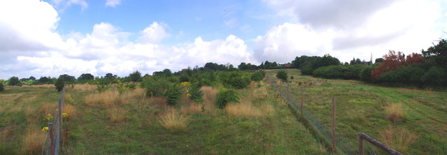
Image: © Glyn Baker Taken: 23 Jul 2017
This former meadow has been planted with native trees and has been protected by a deer resistant fence. The Buffer Lands are former private parks & farmland bought by the City of London Corporation to insulate Epping Forest from the effects of modern farming, to increase biodiversity and to prevent development that might affect the forest. Access is not as universal as in the "real" forest but there are many permissive paths for recreation.
Images are licensed for reuse under creativecommons.org/licenses/by-sa/2.0
Image Location

Latitude
51.688239
Longitude
0.044603