Kirkton Cottage
Introduction
The photograph on this page of Kirkton Cottage by Andrew Wood as part of the Geograph project.
The Geograph project started in 2005 with the aim of publishing, organising and preserving representative images for every square kilometre of Great Britain, Ireland and the Isle of Man.

There are currently over 7.5m images from over 14,400 individuals and you can help contribute to the project by visiting https://www.geograph.org.uk
Kirkton Cottage
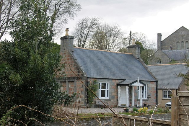
Image: © Andrew Wood Taken: 22 Apr 2017
A listed cottage in the Kirkton of Tough with the kirk itself behind. This cottage which includes the woodland near the church was once a simple cottage, since enlarged, with electricity supplied by a watermill powered generator a few yards upstream.
Images are licensed for reuse under creativecommons.org/licenses/by-sa/2.0
Image Location
Latitude
57.205428
Longitude
-2.638742