Lynmouth
Introduction
The photograph on this page of Lynmouth by Bill Boaden as part of the Geograph project.
The Geograph project started in 2005 with the aim of publishing, organising and preserving representative images for every square kilometre of Great Britain, Ireland and the Isle of Man.

There are currently over 7.5m images from over 14,400 individuals and you can help contribute to the project by visiting https://www.geograph.org.uk
Lynmouth
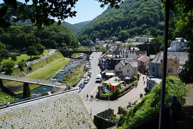
Image: © Bill Boaden Taken: 6 Jul 2017
A view from Mars Hill along the East Lyn River. The wooded East Lyn valley can be seen behind. It is clear how the river has been re-engineered following the flood disaster of 1952.
Images are licensed for reuse under creativecommons.org/licenses/by-sa/2.0
Image Location


Leaflet Map data © OpenStreetMap
Latitude
51.230531
Longitude
-3.83078