Helsbury Castle
Introduction
The photograph on this page of Helsbury Castle by Derek Harper as part of the Geograph project.
The Geograph project started in 2005 with the aim of publishing, organising and preserving representative images for every square kilometre of Great Britain, Ireland and the Isle of Man.

There are currently over 7.5m images from over 14,400 individuals and you can help contribute to the project by visiting https://www.geograph.org.uk
Helsbury Castle
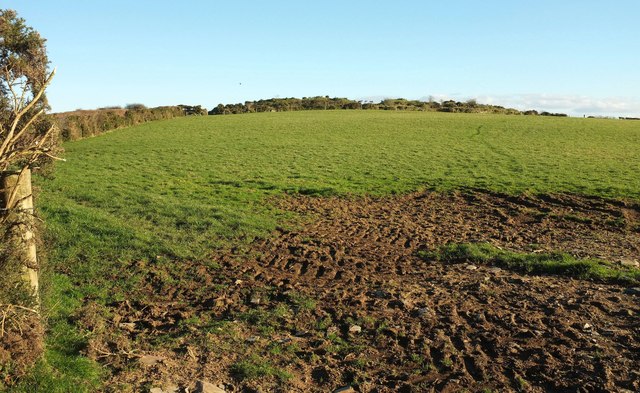
Image: © Derek Harper Taken: 25 Jan 2017
The view in Image of the ring of gorse along the rampart of this univallate hillfort, an ancient monument described at https://www.historicengland.org.uk/listing/the-list/list-entry/1006707 . It contains a medieval chapel and beacon, mapped as Michaelstow Beacon, but neither are visible in this view.
Images are licensed for reuse under creativecommons.org/licenses/by-sa/2.0
Image Location


Leaflet Map data © OpenStreetMap
Latitude
50.584582
Longitude
-4.709602