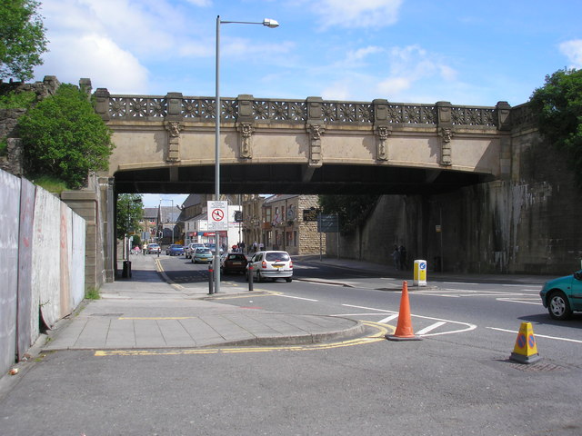
Yorkshire Street, Burnley, Lancashire
Introduction
The photograph on this page of Yorkshire Street, Burnley, Lancashire by Dr Neil Clifton as part of the Geograph project.
The Geograph project started in 2005 with the aim of publishing, organising and preserving representative images for every square kilometre of Great Britain, Ireland and the Isle of Man.
There are currently over 7.5m images from over 14,400 individuals and you can help contribute to the project by visiting https://www.geograph.org.uk

Image: © Dr Neil Clifton Taken: 25 May 2007
Looking eastwards along Yorkshire Street we see it dominated by the aqueduct carrying the Leeds and Liverpool Canal. This structure dates, not from the original opening of the waterway, but from 1927. Even by the 1890s, the original aqueduct which was slightly further to the east, was found to be unduly constricting to traffic along the street, so side arches were bored in that year to take the pedestrian traffic: this, however, was not a sufficient solution, as all the room on the road was taken up by the double track of tramway that was then in situ. So in 1927 this entirely new structure was put in place and the old aqueduct demolished. Beyond the aqueduct can be seen the Princess Royal pub, and beyond that is St. Mary's Roman Catholic church.
Image Location


