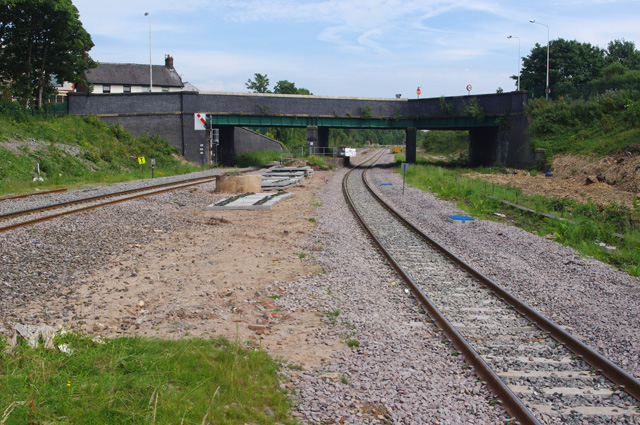
Poulton le Fylde station
Introduction
The photograph on this page of Poulton le Fylde station by Ian Taylor as part of the Geograph project.
The Geograph project started in 2005 with the aim of publishing, organising and preserving representative images for every square kilometre of Great Britain, Ireland and the Isle of Man.
There are currently over 7.5m images from over 14,400 individuals and you can help contribute to the project by visiting https://www.geograph.org.uk

Image: © Ian Taylor Taken: 6 Jul 2017
Looking east towards Station Road overbridge from the end of the existing platform. The platform originally continued beyond the bridge. There used to be additional through lines on the right (south side). It appears that the track has been lowered under the bridge to provide clearance for the overhead wires. For the time being, a semaphore signal remains in use. It remains to be seen following electrification whether direct services to London using Pendolino trains (9- or 11-car) will call here. This will require the platforms to be extended again or opening of the train doors to be inhibited beyond the platform. The existing single daily service uses 5-car Voyager trains and does call here.

