Underpass below the Heads of the Valleys Road, Llanfoist
Introduction
The photograph on this page of Underpass below the Heads of the Valleys Road, Llanfoist by Jaggery as part of the Geograph project.
The Geograph project started in 2005 with the aim of publishing, organising and preserving representative images for every square kilometre of Great Britain, Ireland and the Isle of Man.

There are currently over 7.5m images from over 14,400 individuals and you can help contribute to the project by visiting https://www.geograph.org.uk
Underpass below the Heads of the Valleys Road, Llanfoist
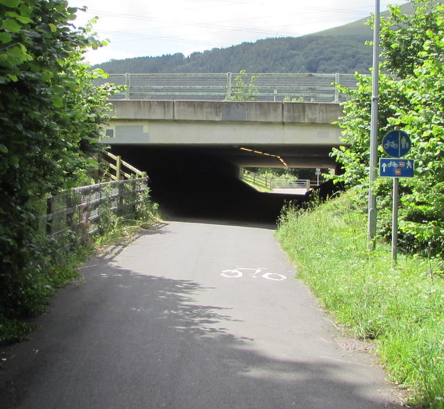
Image: © Jaggery Taken: 11 Jun 2017
This is the northeast side of a subway extending for 60 metres under the A465 Heads of the Valleys Road to the road named The Cutting. A sign shows that this route is part of National Cycle Network route 46. Not yet complete in June 2017, Route 46 will eventually connect Bromsgrove in Worcestershire with Neath in Wales.
Images are licensed for reuse under creativecommons.org/licenses/by-sa/2.0
Image Location
Latitude
51.816417
Longitude
-3.030531