House in Worcester Road, Clifton, Bristol
Introduction
The photograph on this page of House in Worcester Road, Clifton, Bristol by Robin Stott as part of the Geograph project.
The Geograph project started in 2005 with the aim of publishing, organising and preserving representative images for every square kilometre of Great Britain, Ireland and the Isle of Man.

There are currently over 7.5m images from over 14,400 individuals and you can help contribute to the project by visiting https://www.geograph.org.uk
House in Worcester Road, Clifton, Bristol
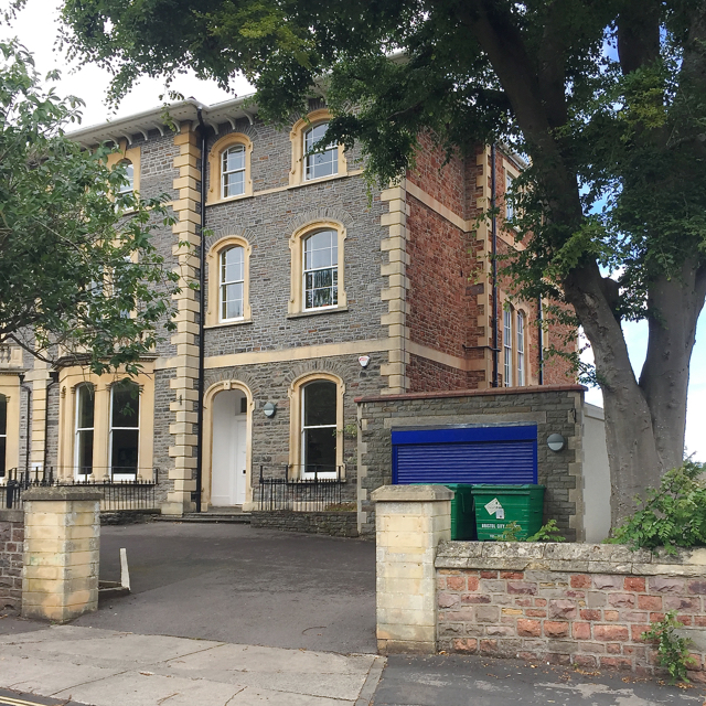
Image: © Robin Stott Taken: 25 Jun 2017
This is but one example of the variety of building stones in Bristol. The frontage is of grey Pennant Sandstone; the dressings are presumed to be Bath Stone; the end wall is probably Dolomitic Conglomerate. Three for the price of one! A display in Bristol Museum and Art Gallery explains: Dolomitic Conglomerate. Deposits that were laid down in desert conditions around the margins of uplands during the Triassic period. Very variable in colour – yellows and reds are most common – and in grain size from fine sand up to large boulders. Uses. Rough walling and coursed squared rubble walling, especially in Clifton and Redland. Sources. Often dug on the spot where houses were built. Quarries on the north side of the King's Weston Ridge supplied a good quality ashlar stone.
Images are licensed for reuse under creativecommons.org/licenses/by-sa/2.0
Image Location
Latitude
51.460016
Longitude
-2.617582