Countdown marker, Ballybracken, Ballynure/Larne (July 2017)
Introduction
The photograph on this page of Countdown marker, Ballybracken, Ballynure/Larne (July 2017) by Albert Bridge as part of the Geograph project.
The Geograph project started in 2005 with the aim of publishing, organising and preserving representative images for every square kilometre of Great Britain, Ireland and the Isle of Man.

There are currently over 7.5m images from over 14,400 individuals and you can help contribute to the project by visiting https://www.geograph.org.uk
Countdown marker, Ballybracken, Ballynure/Larne (July 2017)
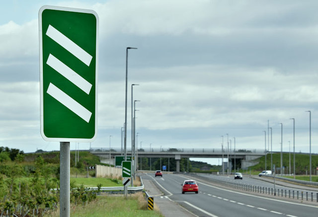
Image: © Albert Bridge Taken: 2 Jul 2017
A countdown marker, on the Larne Road, approaching the Moss Road exit from the Ballynure/Belfast direction. “Countdown markers indicate the distance to the start of the deceleration lane. Each bar represents about 100 yards. These signs may also be used on the approach to a roundabout or crossroads. On non-primary routes, the bars are black on a white background” (Highway Code). The road’s old line Image can be seen at lower left. Note the use of national speed limit signs on the lampposts.
Images are licensed for reuse under creativecommons.org/licenses/by-sa/2.0
Image Location
Latitude
54.802207
Longitude
-5.92132