Wincolmlee, Kingston upon Hull
Introduction
The photograph on this page of Wincolmlee, Kingston upon Hull by Bernard Sharp as part of the Geograph project.
The Geograph project started in 2005 with the aim of publishing, organising and preserving representative images for every square kilometre of Great Britain, Ireland and the Isle of Man.

There are currently over 7.5m images from over 14,400 individuals and you can help contribute to the project by visiting https://www.geograph.org.uk
Wincolmlee, Kingston upon Hull
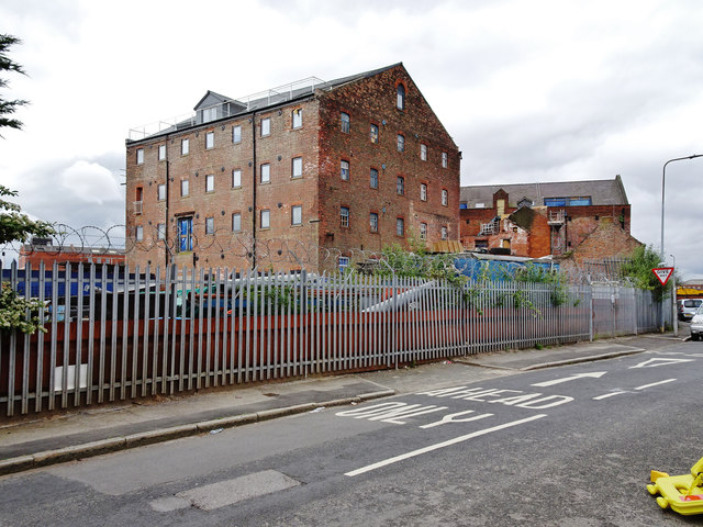
Image: © Bernard Sharp Taken: 25 Jun 2017
Mill building, rear of Nos.194 & 196 Wincolmlee, circa 1850s, derelict for the past 50 years. It is linked to High Flags Mill, No.192 Wincolmlee, by an elevated walkway. The two former mills are currently being converted to provide 44 residential apartments. That depicted is now known as Block 2, the first to be converted, providing 22 apartments.
Images are licensed for reuse under creativecommons.org/licenses/by-sa/2.0
Image Location
Latitude
53.752591
Longitude
-0.332153