Site of "Pedestrian Arms" pub, Newtown Road - June 2017 (1)
Introduction
The photograph on this page of Site of "Pedestrian Arms" pub, Newtown Road - June 2017 (1) by The Carlisle Kid as part of the Geograph project.
The Geograph project started in 2005 with the aim of publishing, organising and preserving representative images for every square kilometre of Great Britain, Ireland and the Isle of Man.

There are currently over 7.5m images from over 14,400 individuals and you can help contribute to the project by visiting https://www.geograph.org.uk
Site of "Pedestrian Arms" pub, Newtown Road - June 2017 (1)
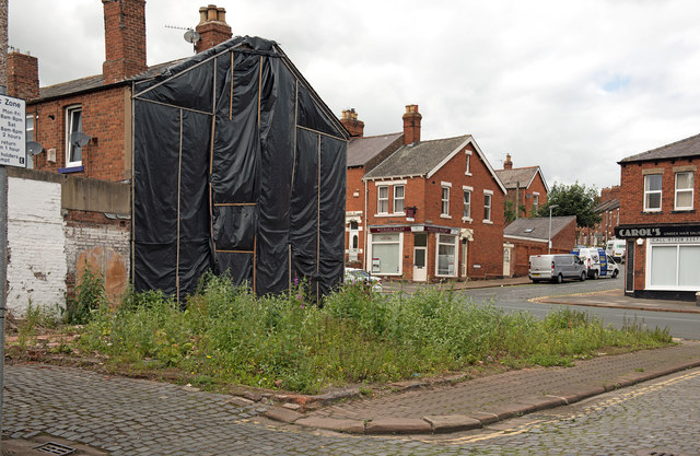
Image: © The Carlisle Kid Taken: 25 Jun 2017
The "Pedestrian Arms" dated from the building of New Town Place (now simply part of Newtown Road) between 1842 and 1848, although the first record of a "beerhouse" on the site does not appear until 1861. Around 1877 the name was changed to "North British Railway Inn" as the North British Railway had its shed and yards not far away. Acquired by the State Management Scheme on 7 September 1916, the name was changed back to "Pedestrian Arms" - possibly to discourage use by off-duty railway staff. Sold by the Scheme to Greenall Whitley on 22 May 1973, the pub closed in 2012 and was demolished in 2015. Views of the demolition may be seen: http://ablogfrommydog.com/contents1a/2015/05/pedestrian-arms-pub-in-carlisle-demolished/ Rose & Trev Clough photographed the pub in 2012 and their view can be seen: Image See also: Image], Image] and Image
Images are licensed for reuse under creativecommons.org/licenses/by-sa/2.0
Image Location
Latitude
54.894231
Longitude
-2.958066