Hazelbank Mill
Introduction
The photograph on this page of Hazelbank Mill by Mike Simms as part of the Geograph project.
The Geograph project started in 2005 with the aim of publishing, organising and preserving representative images for every square kilometre of Great Britain, Ireland and the Isle of Man.

There are currently over 7.5m images from over 14,400 individuals and you can help contribute to the project by visiting https://www.geograph.org.uk
Hazelbank Mill
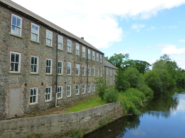
Image: © Mike Simms Taken: 24 Jun 2017
Hazelbank Mill, located beside the River Bann, was listed as a bleach mill in the first OS Maps. In the Griffith Maps it was a spinning mill. By 1878 a weaving mill had been added although the mill was at that time disused. Today, the mill houses a hydroelectric plant and a heat exchanger (neither of them are in this building though).
Images are licensed for reuse under creativecommons.org/licenses/by-sa/2.0
Image Location
Latitude
54.378591
Longitude
-6.302186