Kensal Rise station, 1997
Introduction
The photograph on this page of Kensal Rise station, 1997 by Ben Brooksbank as part of the Geograph project.
The Geograph project started in 2005 with the aim of publishing, organising and preserving representative images for every square kilometre of Great Britain, Ireland and the Isle of Man.

There are currently over 7.5m images from over 14,400 individuals and you can help contribute to the project by visiting https://www.geograph.org.uk
Kensal Rise station, 1997
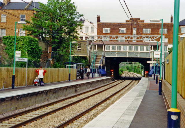
Image: © Ben Brooksbank Taken: 16 May 1997
View NE on the Down platform to the entrance on Chamberlayne Road: North London line (Broad Street (until 1986)/Stratford - Willesden Junction - Richmond), since 2007 London Overground, formerly DC-Third Rail, since 1980s 25 KV AC-Overhead.
Images are licensed for reuse under creativecommons.org/licenses/by-sa/2.0
Image Location
Latitude
51.534373
Longitude
-0.219964