The road to Custard Field Farm
Introduction
The photograph on this page of The road to Custard Field Farm by Nigel Mykura as part of the Geograph project.
The Geograph project started in 2005 with the aim of publishing, organising and preserving representative images for every square kilometre of Great Britain, Ireland and the Isle of Man.

There are currently over 7.5m images from over 14,400 individuals and you can help contribute to the project by visiting https://www.geograph.org.uk
The road to Custard Field Farm
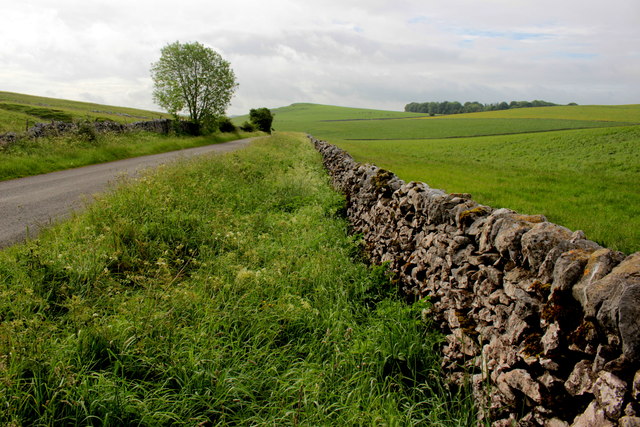
Image: © Nigel Mykura Taken: 10 Jun 2017
This lane bordered with dry stone walls, runs from Cronkston Lodge to the farm. The prominent hill is Mosey Low and the trees to the right of it are at Pilsbury Lodge in SK1164.
Images are licensed for reuse under creativecommons.org/licenses/by-sa/2.0
Image Location
Latitude
53.179536
Longitude
-1.819512