Old Church Tower and graveyard, Auchterarder
Introduction
The photograph on this page of Old Church Tower and graveyard, Auchterarder by Euan Nelson as part of the Geograph project.
The Geograph project started in 2005 with the aim of publishing, organising and preserving representative images for every square kilometre of Great Britain, Ireland and the Isle of Man.

There are currently over 7.5m images from over 14,400 individuals and you can help contribute to the project by visiting https://www.geograph.org.uk
Old Church Tower and graveyard, Auchterarder
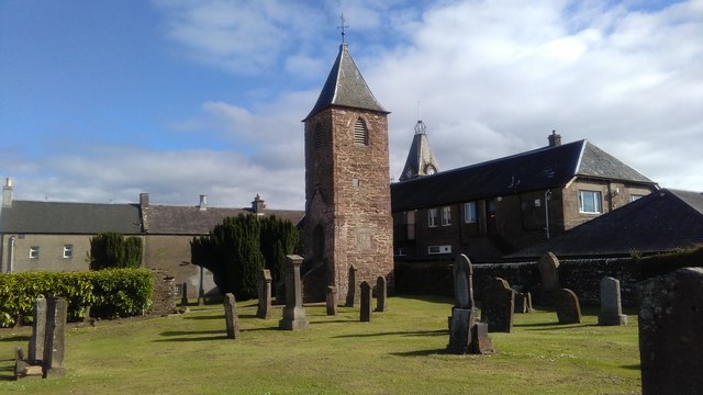
Image: © Euan Nelson Taken: 18 Jun 2017
The tower is all that remains of the church built in 1660. Dedicated to St.Mackessog, the church was removed in 1904 following the construction of a new place of worship on the south side of the High Street.
Images are licensed for reuse under creativecommons.org/licenses/by-sa/2.0
Image Location


Leaflet Map data © OpenStreetMap
Latitude
56.297287
Longitude
-3.707134