Former "The Black Bull", Kirkoswald - June 2017 (1)
Introduction
The photograph on this page of Former "The Black Bull", Kirkoswald - June 2017 (1) by The Carlisle Kid as part of the Geograph project.
The Geograph project started in 2005 with the aim of publishing, organising and preserving representative images for every square kilometre of Great Britain, Ireland and the Isle of Man.

There are currently over 7.5m images from over 14,400 individuals and you can help contribute to the project by visiting https://www.geograph.org.uk
Former "The Black Bull", Kirkoswald - June 2017 (1)
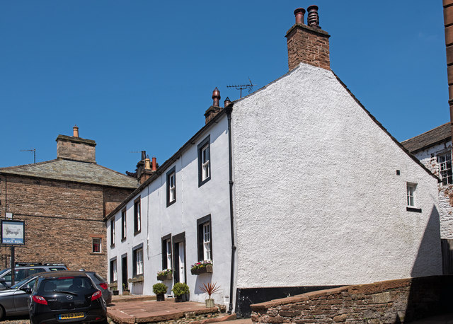
Image: © The Carlisle Kid Taken: 18 Jun 2017
Mid-18th Century former public house, which was acquired by the State Management Scheme on 1 August 1916. While it survived State ownership, the pub is believed to have closed in the mid-1990s. Now a private dwelling with no public access. The former pub sign, which still stands but is somewhat faded, can be seen at far left. See also: Image] .
Images are licensed for reuse under creativecommons.org/licenses/by-sa/2.0
Image Location


Leaflet Map data © OpenStreetMap
Latitude
54.76384
Longitude
-2.692795