Y Ff?r
Introduction
The photograph on this page of Y Ff?r by Alan Fryer as part of the Geograph project.
The Geograph project started in 2005 with the aim of publishing, organising and preserving representative images for every square kilometre of Great Britain, Ireland and the Isle of Man.

There are currently over 7.5m images from over 14,400 individuals and you can help contribute to the project by visiting https://www.geograph.org.uk
Y Ff?r
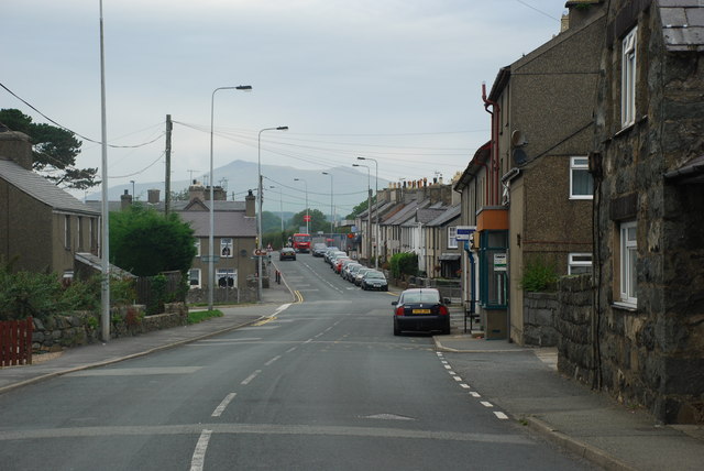
Image: © Alan Fryer Taken: 2 Sep 2007
This view of the village looking towards Yr Eifl on the road from Pwllheli to Caernarfon is almost the same as the 1885 view by John Thomas, the Liverpool-Welsh photographer of the late 19th century - except for the different vehicles http://cairsweb.llgc.org.uk/images/jth/JTH02245.jpg. Surprisingly, the figures on the right are gathered at the very spot which is now the bus-stop.
Images are licensed for reuse under creativecommons.org/licenses/by-sa/2.0
Image Location


Leaflet Map data © OpenStreetMap
Latitude
52.924267
Longitude
-4.384657