Temporary information sign, Bruslee near Ballynure (June 2017)
Introduction
The photograph on this page of Temporary information sign, Bruslee near Ballynure (June 2017) by Albert Bridge as part of the Geograph project.
The Geograph project started in 2005 with the aim of publishing, organising and preserving representative images for every square kilometre of Great Britain, Ireland and the Isle of Man.

There are currently over 7.5m images from over 14,400 individuals and you can help contribute to the project by visiting https://www.geograph.org.uk
Temporary information sign, Bruslee near Ballynure (June 2017)
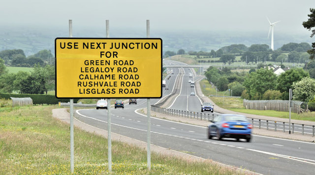
Image: © Albert Bridge Taken: 17 Jun 2017
A temporary (yellow) sign at the northern end of this lay-by Image NI has a higher number of unclassified minor side roads than just about anywhere in GB. The new dual carriageway, with the abolition of right turns, has meant the closure of many accesses and the diversion of traffic to a much smaller number of “LI-LO” (left in-left out) junctions. See also this link http://www.geograph.org.uk/snippet/2324.
Images are licensed for reuse under creativecommons.org/licenses/by-sa/2.0
Image Location
Latitude
54.737233
Longitude
-5.962849