Fairhaven at Kirn
Introduction
The photograph on this page of Fairhaven at Kirn by M J Richardson as part of the Geograph project.
The Geograph project started in 2005 with the aim of publishing, organising and preserving representative images for every square kilometre of Great Britain, Ireland and the Isle of Man.

There are currently over 7.5m images from over 14,400 individuals and you can help contribute to the project by visiting https://www.geograph.org.uk
Fairhaven at Kirn
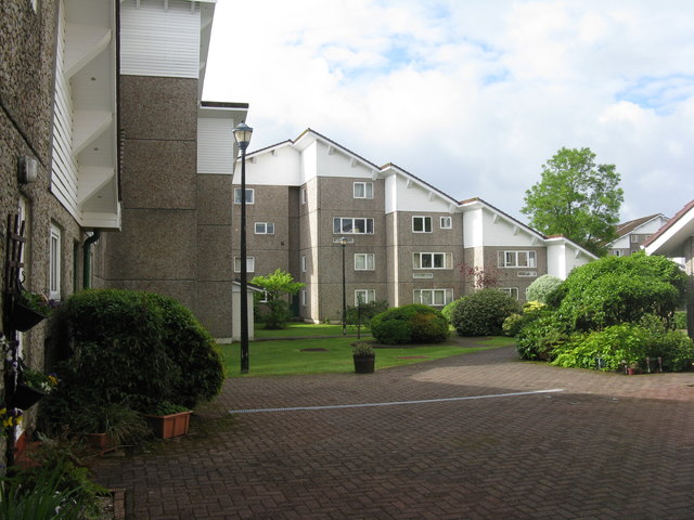
Image: © M J Richardson Taken: 2 Jun 2017
A view of one of the 'courtyard' areas. An interesting housing development, seen here from Ardenslate Road. Built, I have been told, in the 1960s for the American forces based at Holy Loch, but I have been unable to find any details. There are 10 V-shaped blocks, each of about 9-10 interlocking flats and maisonettes, in a pleasant landscaped garden setting. As a housing development it is far more attractive than the standard UK 1960s housing blocks.
Images are licensed for reuse under creativecommons.org/licenses/by-sa/2.0
Image Location
Latitude
55.961762
Longitude
-4.917736