Lambeth Green on Lambeth Palace Road at York Road, 1950
Introduction
The photograph on this page of Lambeth Green on Lambeth Palace Road at York Road, 1950 by Ben Brooksbank as part of the Geograph project.
The Geograph project started in 2005 with the aim of publishing, organising and preserving representative images for every square kilometre of Great Britain, Ireland and the Isle of Man.

There are currently over 7.5m images from over 14,400 individuals and you can help contribute to the project by visiting https://www.geograph.org.uk
Lambeth Green on Lambeth Palace Road at York Road, 1950
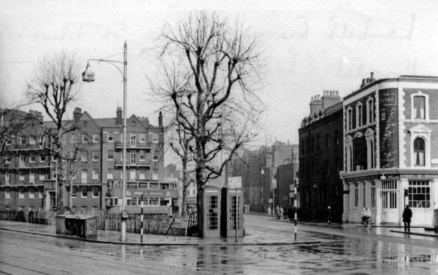
Image: © Ben Brooksbank Taken: 25 Mar 1950
View east, with St Thomas' Hospital behind camera. This was before major alterations here in the 1960s: expansion of St Thomas's Hospital, diversion of Lambeth Palace Road to bend eastward and abolition of the tramlines; also of the Mitre pub and of the phone-boxes. York Road no longer ends here, by the Mitre, but some way back and on the north side of Westminster Bridge Road.
Images are licensed for reuse under creativecommons.org/licenses/by-sa/2.0
Image Location


Leaflet Map data © OpenStreetMap
Latitude
51.499046
Longitude
-0.117175