St Tudy: school and church
Introduction
The photograph on this page of St Tudy: school and church by Derek Harper as part of the Geograph project.
The Geograph project started in 2005 with the aim of publishing, organising and preserving representative images for every square kilometre of Great Britain, Ireland and the Isle of Man.

There are currently over 7.5m images from over 14,400 individuals and you can help contribute to the project by visiting https://www.geograph.org.uk
St Tudy: school and church
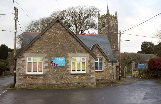
Image: © Derek Harper Taken: 22 Jan 2017
"The present school dates back to 1863 ... a number of cottages were demolished to make way for the school building" http://s3.spanglefish.com/s/31370/documents/st-tudy-school/schooling-in-st-tudy-by-joy-knight.pdf (an interesting history). In the background is the grade I listed church of St Uda https://www.historicengland.org.uk/listing/the-list/list-entry/1162144 .
Images are licensed for reuse under creativecommons.org/licenses/by-sa/2.0
Image Location


Leaflet Map data © OpenStreetMap
Latitude
50.554019
Longitude
-4.731851