Carlisle Ping-Pong Club - Market Street - June 2017
Introduction
The photograph on this page of Carlisle Ping-Pong Club - Market Street - June 2017 by The Carlisle Kid as part of the Geograph project.
The Geograph project started in 2005 with the aim of publishing, organising and preserving representative images for every square kilometre of Great Britain, Ireland and the Isle of Man.

There are currently over 7.5m images from over 14,400 individuals and you can help contribute to the project by visiting https://www.geograph.org.uk
Carlisle Ping-Pong Club - Market Street - June 2017
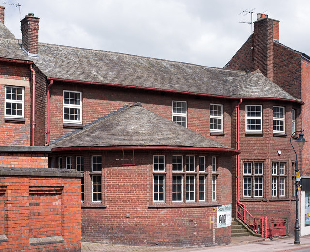
Image: © The Carlisle Kid Taken: 7 Jun 2017
Part of the Methodist Central Hall dating from 1922, the 1925 OS Map suggests this may be a later addition (which is clearly shown on the 1938 OS Map). This portion appears to host the local ping-pong club.
Images are licensed for reuse under creativecommons.org/licenses/by-sa/2.0
Image Location


Leaflet Map data © OpenStreetMap
Latitude
54.89592
Longitude
-2.937368