Former "Drove Inn", Stanwix - June 2017
Introduction
The photograph on this page of Former "Drove Inn", Stanwix - June 2017 by The Carlisle Kid as part of the Geograph project.
The Geograph project started in 2005 with the aim of publishing, organising and preserving representative images for every square kilometre of Great Britain, Ireland and the Isle of Man.

There are currently over 7.5m images from over 14,400 individuals and you can help contribute to the project by visiting https://www.geograph.org.uk
Former "Drove Inn", Stanwix - June 2017
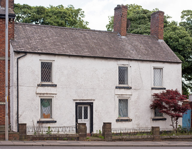
Image: © The Carlisle Kid Taken: 7 Jun 2017
Another pub shown on both the 1866 and 1901 OS Maps, which is not marked as a pub on the 1925 Map. State Management Scheme records indicate it was purchased by the State on 1 August 1916 - and probably promptly closed! Likely a private dwelling for the past 100 years or so.
Images are licensed for reuse under creativecommons.org/licenses/by-sa/2.0
Image Location
Latitude
54.902573
Longitude
-2.937054