Sandy Park Inn
Introduction
The photograph on this page of Sandy Park Inn by Nigel Mykura as part of the Geograph project.
The Geograph project started in 2005 with the aim of publishing, organising and preserving representative images for every square kilometre of Great Britain, Ireland and the Isle of Man.

There are currently over 7.5m images from over 14,400 individuals and you can help contribute to the project by visiting https://www.geograph.org.uk
Sandy Park Inn
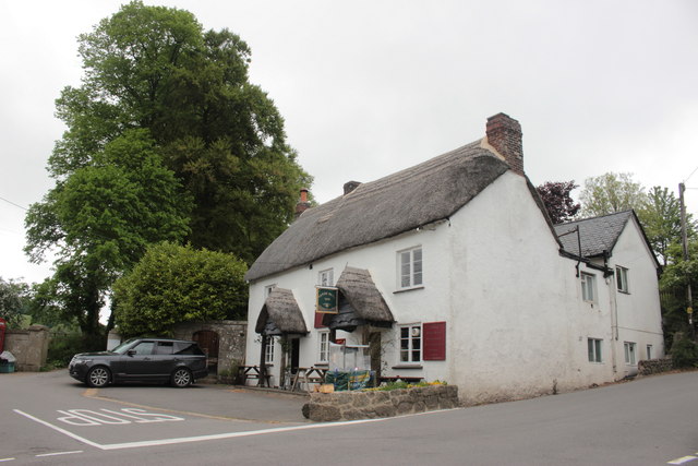
Image: © Nigel Mykura Taken: 22 May 2017
This public house stands right on the crossroads of the A382 and the minor road from Chagford to Drewsteignton. It is in the centre of this very small village that is no more than a cluster of a few houses.
Images are licensed for reuse under creativecommons.org/licenses/by-sa/2.0
Image Location
Latitude
50.691834
Longitude
-3.825154