The Old Kirk of Largs
Introduction
The photograph on this page of The Old Kirk of Largs by Raibeart MacAoidh as part of the Geograph project.
The Geograph project started in 2005 with the aim of publishing, organising and preserving representative images for every square kilometre of Great Britain, Ireland and the Isle of Man.

There are currently over 7.5m images from over 14,400 individuals and you can help contribute to the project by visiting https://www.geograph.org.uk
The Old Kirk of Largs
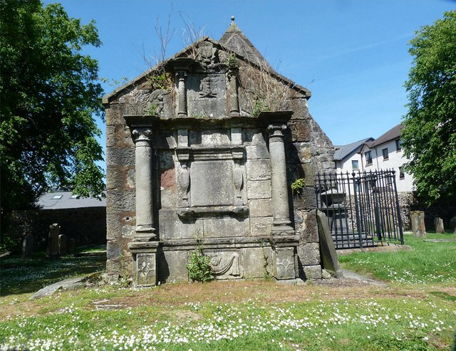
Image: © Raibeart MacAoidh Taken: 31 May 2017
In 1802 the Old Kirk of Largs was demolished when a new parish church came into use. Only two parts of the original kirk were not destroyed; one was the Skelmorlie Aisle, and the other was a section of the south wall, supporting a very fine monument to the Boyle's of Kelburn.
Images are licensed for reuse under creativecommons.org/licenses/by-sa/2.0
Image Location
Latitude
55.79464
Longitude
-4.868677