Bench mark on the former Rose and Crown Public House
Introduction
The photograph on this page of Bench mark on the former Rose and Crown Public House by John S Turner as part of the Geograph project.
The Geograph project started in 2005 with the aim of publishing, organising and preserving representative images for every square kilometre of Great Britain, Ireland and the Isle of Man.

There are currently over 7.5m images from over 14,400 individuals and you can help contribute to the project by visiting https://www.geograph.org.uk
Bench mark on the former Rose and Crown Public House
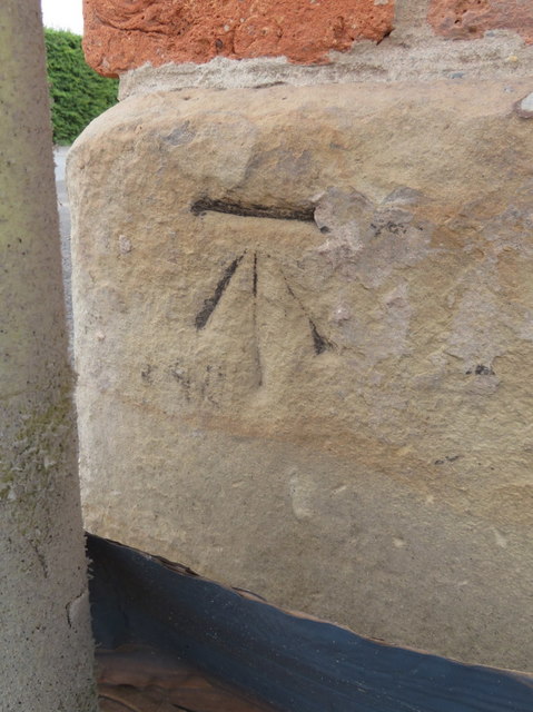
Image: © John S Turner Taken: 31 May 2017
This Ordnance Survey bench mark is on the north east corner of the former Rose and Crown Public House at the New Brighton cross roads. The pub is in the process of being converted into houses, and the external paint has been stripped off the walls revealing the old cut mark. The mark pre-dates the 1872 Ordnance Survey map, and was superseded by a mark on a new outbuilding from 1961. That outbuilding is now demolished, so neither mark are on the O.S. database. See also Image
Images are licensed for reuse under creativecommons.org/licenses/by-sa/2.0
Image Location
Latitude
53.180809
Longitude
-3.117714